Yakushima Hiking Guide: Forest Walks, Conditions and Logistics
Choose the forest experience you want, then check the road, trail and return journey that make it possible.
- Short walks are not summit hikes
- Road access is a separate check
- Keep a weather alternative
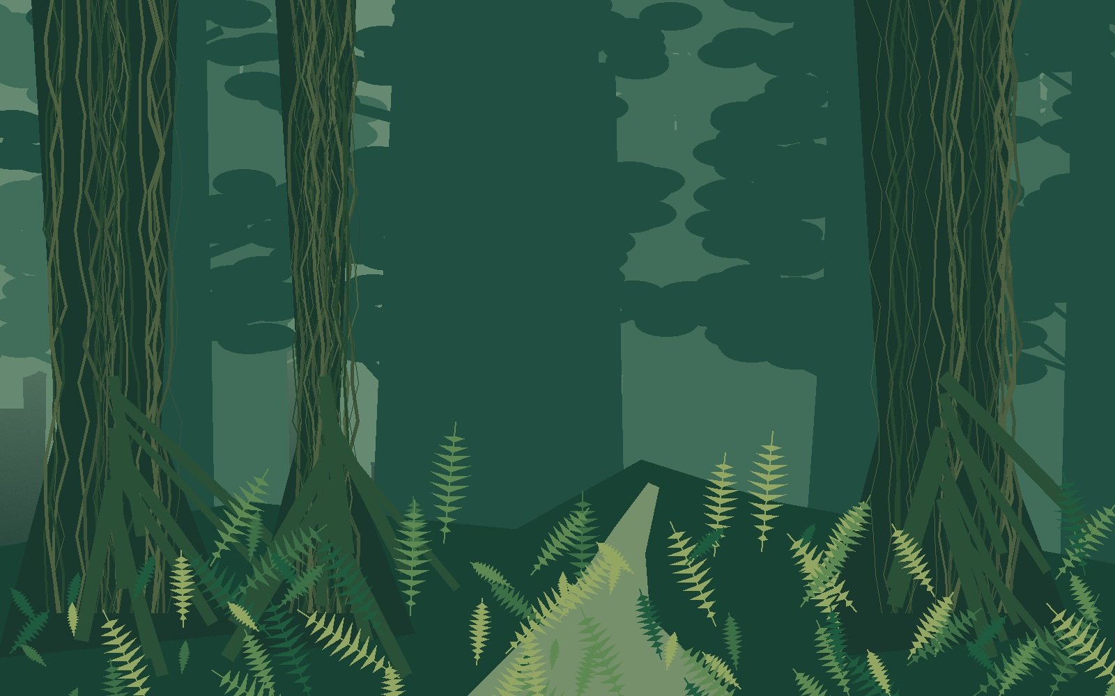
An original illustrated interpretation of Yakushima’s forest atmosphere, not a photograph or a depiction of a currently open path.
Yakushima rewards a change of pace: looking closely at cedar roots and moss can be a better day than collecting a famous tree at the end of a long march. The island offers short forest paths, substantial day hikes and demanding mountain objectives. Their names are not interchangeable, and an open attraction does not necessarily mean every path is usable.
This Yakushima hiking guide starts with the experience and effort you want, then adds access, transport, accommodation and a return-time test. It is a planning guide rather than live navigation or a substitute for local route advice.
This article contains affiliate links. If you book or buy through them, Taylor’s Trailblazing Travels may earn a commission. Recommendations are chosen for their relevance to the trip.
Walk choice
Select a route by effort and experience, not fame alone.
Current access
A reopened road does not certify every connecting trail.
Base choice
Match your hotel to the trailhead and morning transport.
Return plan
Treat a bus or booked collection as a hard planning boundary.
Check the current Yakushima hiking access
The town’s 16 October update reports access restored towards Jomon Sugi and the Yodogo trailhead, with Shiratani road restrictions easing to alternating one-way traffic from 18 October. That is a dated access position, not a forecast for a later trip. [7] Check the town, tourism association and recreation-forest council again the evening before and on the morning of the walk.
Make three separate checks: the road to the entrance, the precise trail you intend to use, and the weather expected during the outing. A bus timetable does not establish that a storm-damaged trail is open. Equally, a general park closure reported weeks ago can be overtaken by a newer, partial reopening.
When the wording or map is unclear, ask your guide or visitor centre to identify the permitted route. Do not combine an old trail map with a new road announcement and assume the gap between them has been resolved.
Choose among genuinely different forest days
| Choice | Normal scale | Who should consider it |
|---|---|---|
| Yakusugi Land shorter paths | Nominal 30- and 50-minute options | Visitors seeking a shorter cedar-forest outing; check current path arrangements |
| Yakusugi Land longer circuits | Nominal 80-, 150- and 210-minute options | Walkers equipped for rougher trails, not expecting an entirely easy promenade |
| Shiratani to Taiko-iwa | About 5.5 km; 4–5 hours return | Walkers wanting a substantial forest hike and viewpoint, when the route is open |
| Jomon Sugi from Arakawa | About 22 km; 9–10 hours return | Fit walkers prepared for a long, early-start hiking day |
| Miyanoura-dake | A demanding mountain objective | Experienced mountain walkers with appropriate conditions, equipment and local advice |
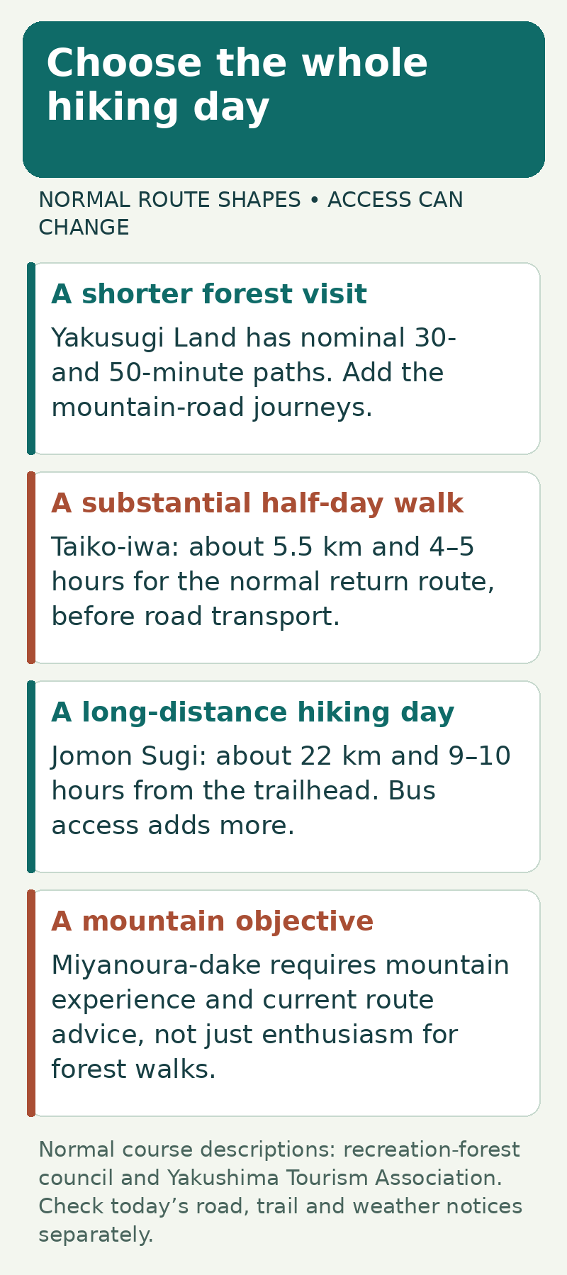
Course-name minutes are not your hotel-to-hotel outing. Photography, queues at narrow sections, lunch and slower footing extend the time, as do the mountain-road journeys. The easiest advertised option is not automatically wheelchair accessible; check the exact surface, steps, bridges and facilities for your needs.
For a first forest day, choose a route shorter than your maximum comfortable effort. That leaves attention for the landscape and gives you useful information about your footwear, pace and the conditions before considering a longer day.
Understand what the famous hikes require
Jomon Sugi: distance is the main commitment
The tourism association’s normal route description combines about 8.5 km of old railway track with roughly 2.5 km of mountain trail each way. The return distance is the important figure; reaching the tree is only the midpoint. From 1 March to 30 November, ordinary private-car access to the Arakawa trailhead is restricted; hikers normally use the dedicated Arakawa mountain shuttle bus from the Yakusugi Museum area. Check ticket and conservation-contribution arrangements before travelling. [5]
This is not a sensible first activity immediately after a late ferry arrival. Have your onward transport, breakfast or packed food, equipment and return plan organised beforehand. A guided day can help with these interfaces, but does not make the distance disappear.
Shiratani and Yakusugi Land: shorter does not mean weather-proof
Shiratani can offer mossy forest and a viewpoint without the Jomon Sugi distance, but stream levels and the permitted path still control the day. At Yakusugi Land, choose a specific circuit rather than arriving with “the park” as the whole plan. Its forest lies roughly 1,000–1,300 metres above sea level, so coastal conditions do not describe the walk. [3][8]
Ask at reception which trails are open and which route is appropriate for the day. A closed section of a longer circuit may remove the route you had saved, even if the entrance remains open.
Miyanoura-dake: do not confuse a summit with a forest stroll
The official route page flags this as unsuitable for mountain beginners. It also contains differing time statements between its introduction and route table, so do not build a tight departure around the shortest number. Obtain a current route-specific estimate from a competent local guide and plan it as a mountain day with weather and daylight margins. [6]
Fit the hike inside a real return window
First fix the return transport you can actually use. Then subtract a protected reserve and ask whether your chosen walk still fits. The example below is deliberately hypothetical: a vehicle drops you at a trailhead at 09:30 and your booked collection is at 15:30. These are not published bus times.
| Step | Calculation | Result |
|---|---|---|
| Time between drop-off and collection | 15:30 − 09:30 | 6 hours |
| Protect an unexpected-delay reserve | 6 hours − 1 hour | 5 hours available for the planned outing |
| Proposed walk plus breaks | 4 hours + 45 minutes | 4 h 45 min; 15 min below the planned limit |
| Walking takes 25% longer | 5 hours + 45 minutes | 5 h 45 min; protected reserve breached |
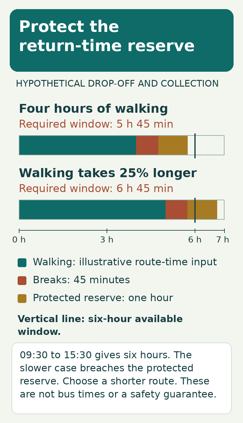
In the slower case, choose a shorter route or arrange a different day with appropriate transport. Do not treat the protected hour as extra sightseeing time. The example also assumes that the whole return route remains usable; a closure, unsafe stream or deteriorating forecast overrides the arithmetic.
For an out-and-back walk, agree a turnaround time before leaving and review progress at sensible waypoints. Do not assume that the descent will be much faster on wet roots or steps. Your slowest group member, rather than your fastest, determines whether the plan works.
Match the base, morning pickup and island arrival
| Base | Planning advantage | Potential drawback |
|---|---|---|
| Anbo / Anbo side | Useful starting shortlist for Yakusugi Land and Arakawa-side plans | Still requires a mountain-road journey and correct pickup arrangements |
| Miyanoura | Useful for the port and a Shiratani-focused plan | Not the same starting point as Anbo for the Arakawa bus |
| South-coast accommodation | Can suit a slower stay with non-hiking days | May add a substantial early drive or fall outside a guide’s pickup area |
Before choosing a room, ask whether the provider picks up at that exact property, at what time, and whether an early breakfast or packed meal is available. When travelling without a car, also test the evening meal and shopping journeys. An inexpensive isolated room can become impractical when every outing needs an extra vehicle.
The tourism association published a bus-timetable change for 1 October 2026. Use the timetable valid for your dates and your named stop, not a screenshot saved from a summer itinerary. The local transport guide also distinguishes the dedicated Arakawa hiking bus from the general island bus network. [9][13]
For access from Kagoshima, 12Go lists ferry and flight options. Check the arrival port or airport and the operator’s cancellation and baggage terms before tying it to a hotel or guide. A Kagoshima Airport arrival and a Kagoshima harbour departure are different places with a connecting journey between them. [12]
Avoid making an inflexible international connection depend on the final boat or flight off the island. An extra mainland night buys a different sort of value from an extra summit attempt: it reduces the consequences of a delayed island departure.
Budget for forest entry, food and the less obvious costs
From 1 April 2026, the council’s published standard admission contribution is ¥800 per person of high-school age and above at each of Yakusugi Land and Shiratani. The previous ¥200 cross-site discount coupon was discontinued. At that standard rate, two adults visiting both sites would allow ¥3,200 in total for those entries alone. [10]
This is separate from the mountain-conservation contribution described for Jomon Sugi: ¥1,000 for a day visit to the mountains or ¥2,000 for a mountain overnight. The overnight category refers to staying in the mountains, not simply sleeping in a hotel on Yakushima. [11]
Add the relevant bus or transfer, guide where used, packed food, equipment rental, room charges and any changeable island transport. Do not treat a tour’s headline price as all-inclusive: confirm forest admission, lunch, pickup area, rainwear and cancellation terms item by item.
Prepare for wet terrain and an interrupted plan
Rain is part of the island’s environment, but that does not make every rainy day a suitable walking day. The tourism association warns that mountain temperatures differ markedly from the coast and that snow and ice can close access roads in winter. [8] Check a mountain-relevant forecast and the operator’s current decision, not just a sunny harbour photograph.
Use footwear with appropriate grip, waterproof outer layers, warm layers, a headtorch, food, water, a charged phone and a protected spare power supply. Pack critical items so they stay dry when the bag becomes wet. Carry a portable toilet kit and know its proper disposal arrangements; the tourism association’s current notices report disrupted toilet facilities on the Jomon Sugi route. [9]
Leave the day’s route and expected return with someone who knows what to do if you fail to return. Follow closures, keep to the permitted trail, do not damage moss or roots for a photograph, and do not cross unsafe rising water to keep an appointment. A guide is particularly valuable when your experience, equipment or confidence does not match the route.
Mobile data can help with hotel, port and operator messages where coverage exists, but it is not a guaranteed mountain connection or a rescue system. Download essential information before the outing and establish your emergency communication plan separately.
Build a stay that can absorb one lost hiking day
For an illustrative four-night stay, use arrival day for checking conditions, equipment and food. Keep the next two full days available for your first-choice and secondary forest outings, and retain the remaining full day as a weather, rest or lower-level alternative. Depart after the fourth night. This is a flexible framework, not a promise that any two routes will be open.
Put the most important suitable walk on the first good day rather than saving it for the final morning. When a difficult hike is cancelled, a shorter open forest visit, visitor centre or coastal plan may still make a good trip. Check their access too; do not replace one closed mountain route with another guessed route.
Is a guide compulsory for every forest visit?
Do not assume the same rule applies everywhere. Check the current access conditions for the precise route. A guide’s usefulness depends on your route, experience and logistical needs; choosing one does not override a closure or remove the need for suitable equipment.
Can I visit Yakushima only for Jomon Sugi?
You can make it the main aim, but a trip that has value only if one long hike succeeds is fragile. Allow alternatives and avoid placing all non-refundable travel immediately around a single weather-dependent day.
Do a reopened road and a current ticket guarantee the hike?
No. Road access, trail permission, the actual weather and personal suitability are separate requirements. Reconfirm all of them before setting out.
Your next decision
Choose the forest day that matches your ability, then make the road, trail and return journey agree. Shorter Yakushima walks can be rewarding in their own right. A longer hike deserves more preparation, not just an earlier alarm, and a sensible alternative is part of a complete plan rather than an afterthought.
How this guide was prepared
Current access information was checked against the council’s 16 and 18 October 2026 notices and the town update. Normal course descriptions are kept separate from temporary restrictions. The return-window calculation and four-night framework are original planning examples, not live timetables, a safety certification or firsthand hiking reports.
Sources
Information reviewed on 18 October 2026. Check current operating notices, prices and booking conditions for your travel dates. Some local primary sources are in Japanese.
- Yakushima Recreation Forest Council — Shiratani reopening and remaining restrictions, 16 October 2026
- Yakushima Recreation Forest Council — Shiratani daily bulletin, 18 October 2026
- Yakushima Recreation Forest Council — Yakusugi Land overview and official map links
- Yakushima Tourism Association — trekking route overview
- Yakushima Tourism Association — Jomon Sugi route, distance and seasonal road-access restrictions
- Yakushima Tourism Association — Miyanoura-dake route information
- Yakushima Town — mountain access update, 16 October 2026
- Yakushima Tourism Association — climate and visitor questions
- Yakushima Tourism Association — current transport and toilet notices
- Yakushima Recreation Forest Council — admission revision from April 2026, official English notice
- Yakushima Tourism Association — Jomon Sugi and mountain conservation contribution
- 12Go — Kagoshima–Yakushima transport comparison
- YES Yakushima — local transport and Arakawa access explanation
- Yakushima Tourism Association — Taiko-iwa normal return-course distance and time
Illustrations in this article were created for Taylor’s Trailblazing Travels. Third-party photographs, where used, are credited beside the image or in the source list.